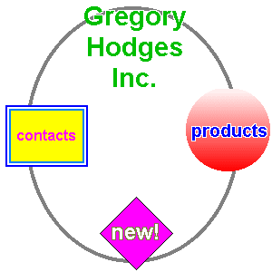
Just a nice gimic, the OBIEE image prompt. First get a image, I used this one: http://www.faqs.org/docs/htmltut/images/testmap.gif

Create a image prompt:


Next use the HTML SHAPE tag to add the coordinates: http://www.faqs.org/docs/htmltut/images/_AREA_SHAPE.html
<MAP NAME="map1"> <AREA HREF="contacts.html" ALT="Contacts" TITLE="Contacts" SHAPE=RECT COORDS="6,116,97,184"> <AREA HREF="products.html" ALT="Products" TITLE="Products" SHAPE=CIRCLE COORDS="251,143,47"> <AREA HREF="new.html" ALT="New!" TITLE="New!" SHAPE=POLY COORDS="150,217, 190,257, 150,297,110,257"> </MAP>

Press Extract Image Map from HTML

add the column and value.
Till Next Time
Gotta say it: LOL ;-)
ReplyDeleteHi john,
ReplyDeleteI need to create prompt from the pie chart. If a user clicks on a particular section of pie chart it should open up another report and the corresponding value needs to be passed as a prompt value.
lets,
ReplyDeleteIt sounds like what you want to do here is create the pie chart as a view in your request. Then on the Interaction tab under Additional Charting Options, select Navigate and indicate which request you want the user to be sent to. Just make sure the appropriate column has an "is prompted" filter on it in the target request.
Hi John,
ReplyDeleteWould it be posible to go from one image prompt to a new image prompt, lets say show a world map and user clicks on North America it would then show the user a US and Canada map to select on. Let me know if this is possible.
@ronald.maus,
ReplyDeleteSounds more like Oracle Spatials or even better wait for OBIEE 11G.
Regards
John
Hi John,
ReplyDeleteFirst of all thanks a lot for your blogs!
I know we can do map drill down with Oracle Mapviewer and Spatial, or as you said OBIEE 11g. But is it possible to do some of the same functionality with javascript and using Navigation command?
I tried putting a narrative view on a map as IFRAME
src=http://40.110.140.230:7777/dashboardfiles/map.gif height="600" width="100%" href=http://40.110.140.230:7777/analytics/saw.dll?GO&NQUser=Administrator&NQPassword=Administrator&Path=/shared/Dashboard+Mockups/DistrictEastern&Action=Navigate></IFRAME
I can see the map image but upon clicking on the map image it doesn't navigate to the target report.
Is there a way to make the colors of the image change according to the conditional formats of the report?
ReplyDelete@Anonymous check out Venkat blog on integrating mapviewer
ReplyDelete@Coques,
ReplyDeleteNot that i'm aware of....
Regards
Hi John, i am working on this same issue for the 11g version. Can you please help me figure out how or where to put the image on the weblogic server, rather than on the oc4j, it seems different!
ReplyDeletethank you for your post! Very useful
ReplyDeleteThis comment has been removed by the author.
ReplyDeleteI wanted to implement the Geo and struggled to get map view and then again struggled to get the data to map it with. It is pain here in OBIEE. Now you can achieve this thing easily with image prompt by having appropriate column in your data set(Say continent mapped with Geo). And also images can be customized easily for user needs. Might not suffice for deep down analytics, but believe me. Most of our requirements can be solved by this.
ReplyDelete